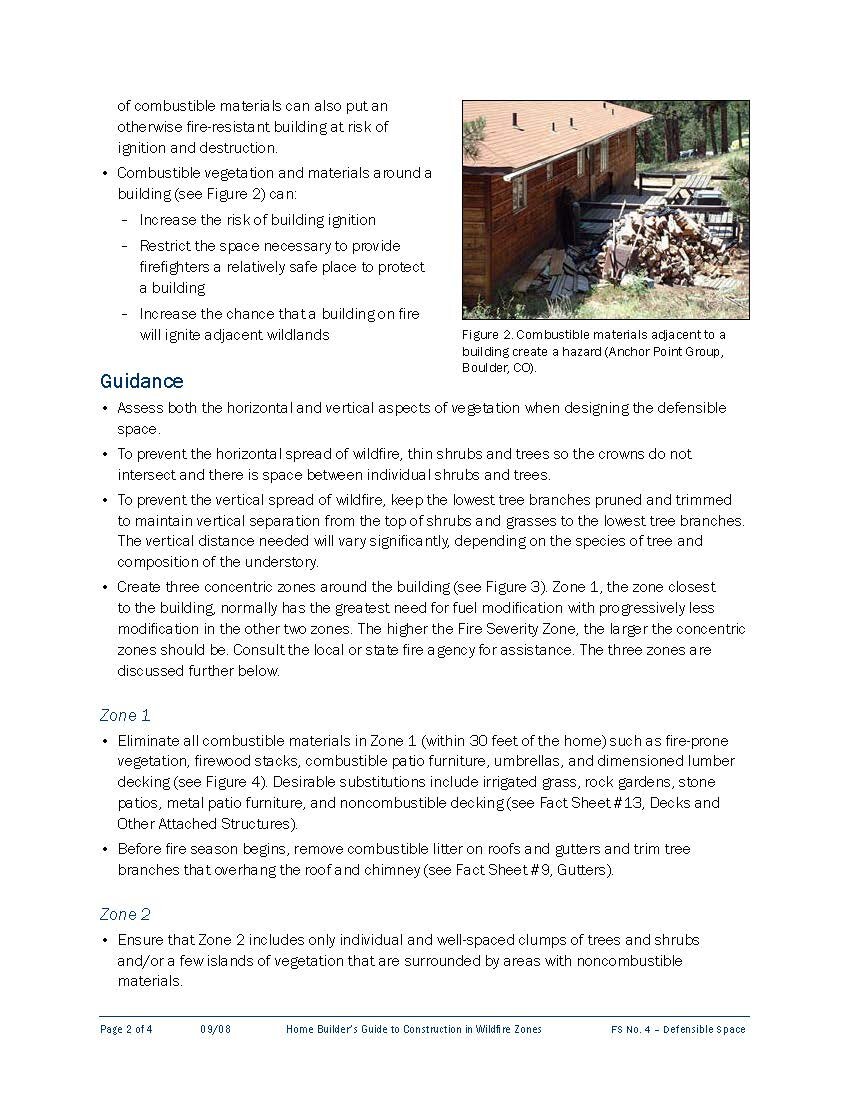
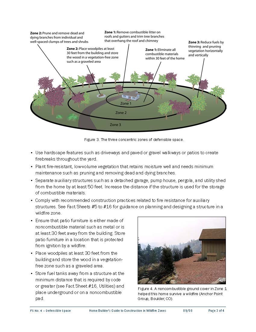
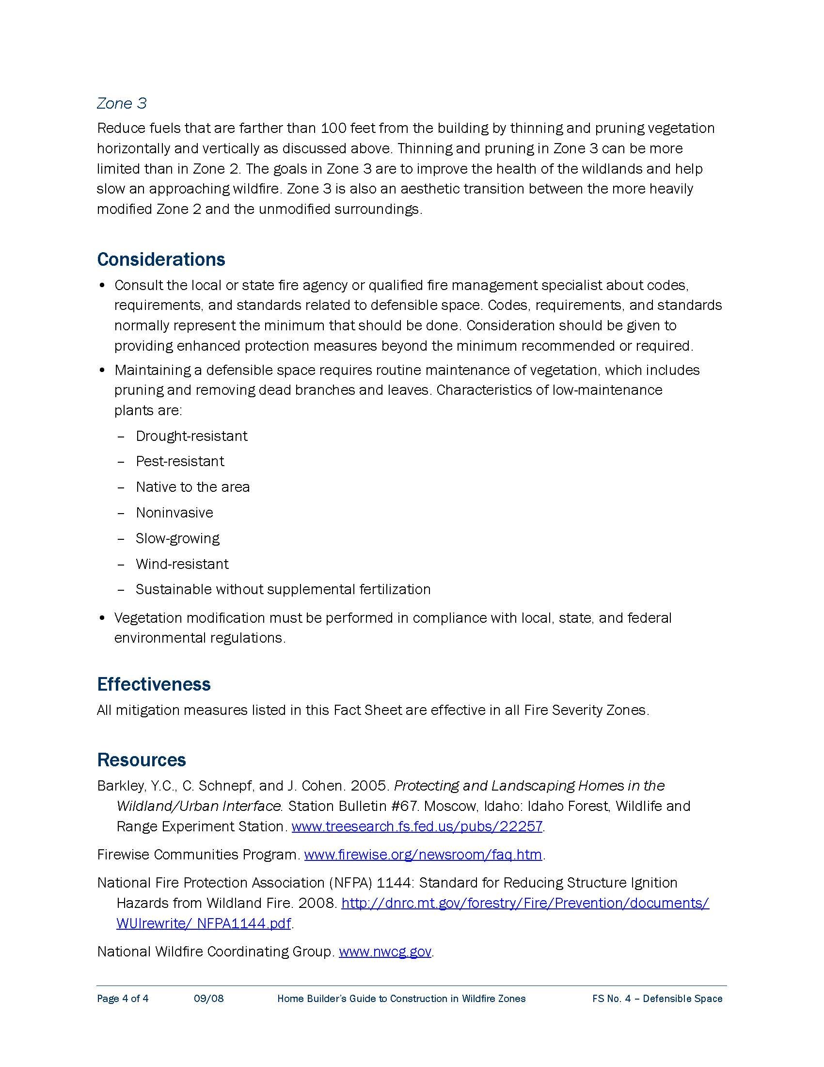
PVNU’s Proposed Wildfire Safety Ordinance
prior assessments of wildfire hazard in portola valley
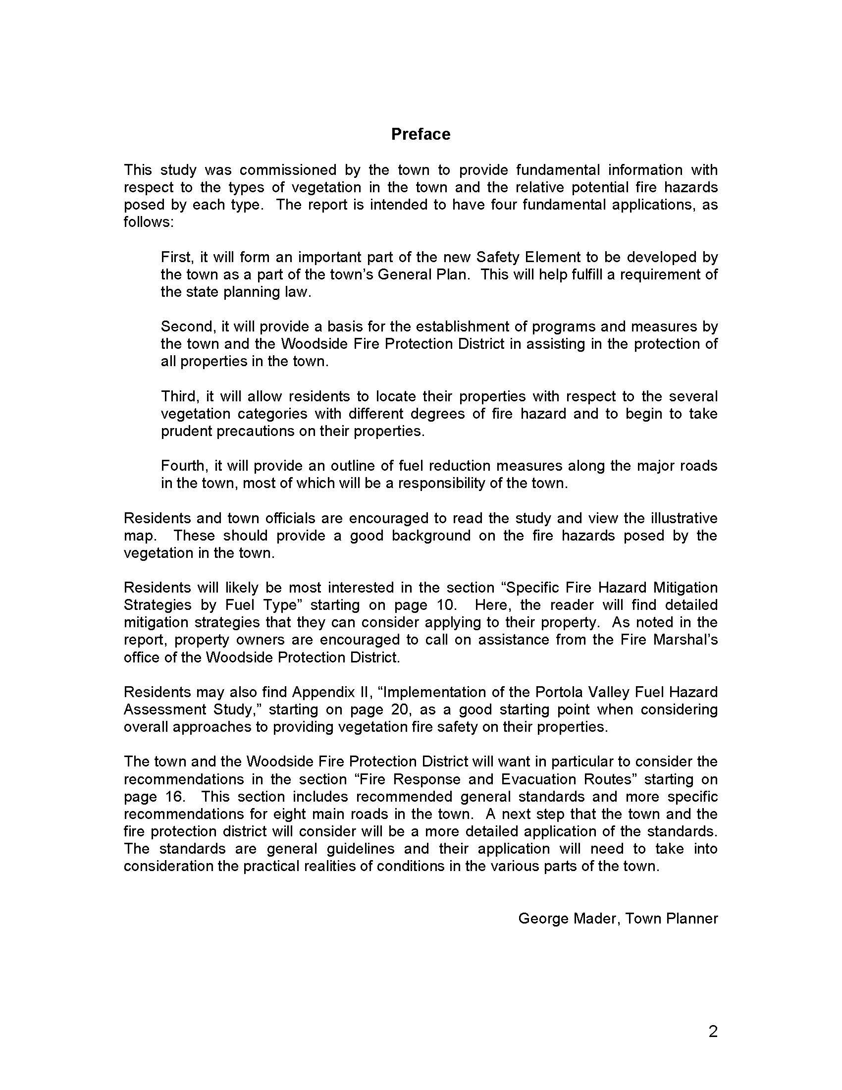
In 2008 the Town engaged Moritz Arboricultural Consultants to perform a comprehensive assessment of the different types of combustible, fire-prone vegetation within Portola Valley and the potential fire hazards posed by each type. The resulting report was explicitly intended to:
Form an important part of the General Plan’s Safety element;
Provide a basis to establish programs and measures by the Town and the Woodside Fire Protection District to help protect all properties in town;
Allow residents to assess the degree of fire hazard to which their properties are exposed and take prudent precautions for their properties; and
Outline the fuel reduction measures to be taken by the Town along each of the major roads within town.
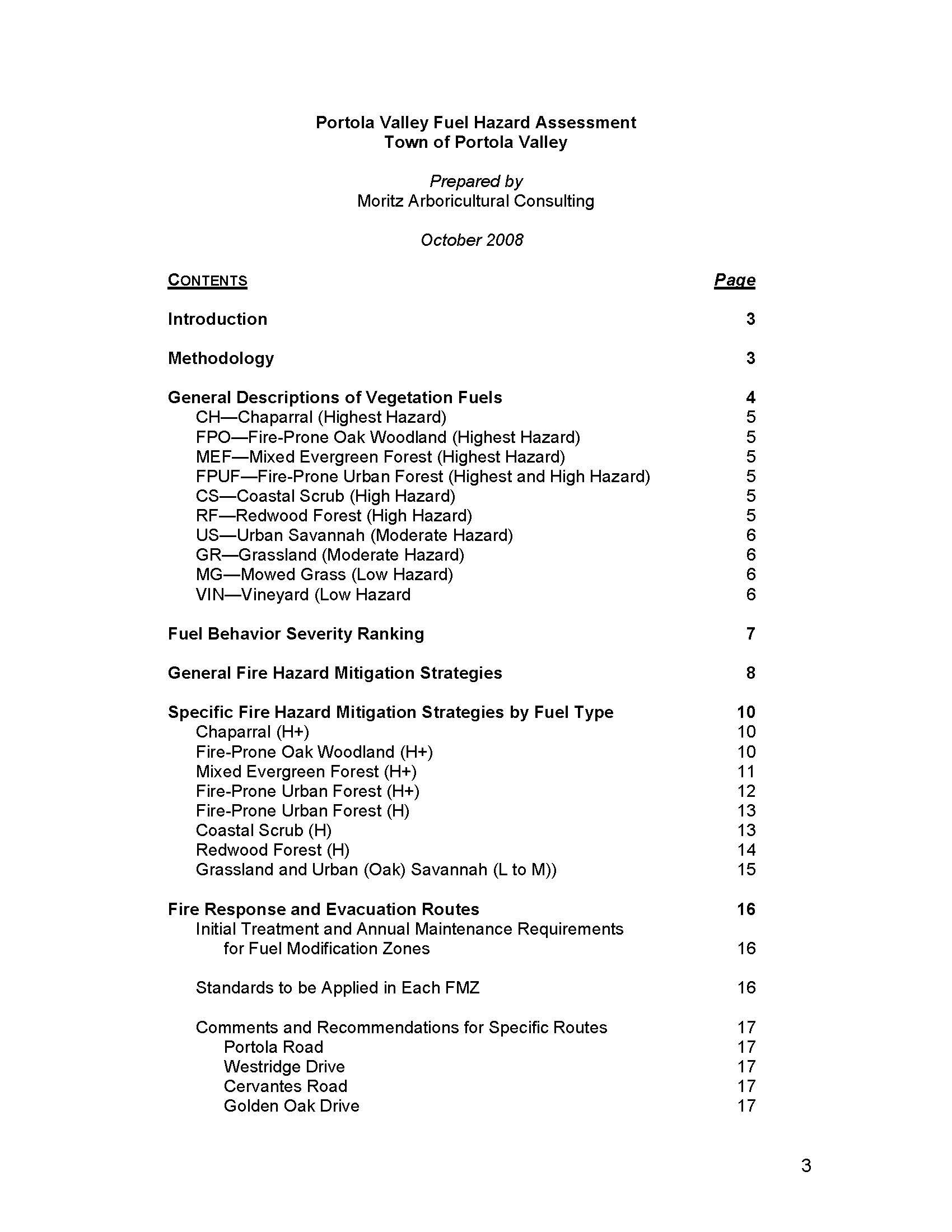
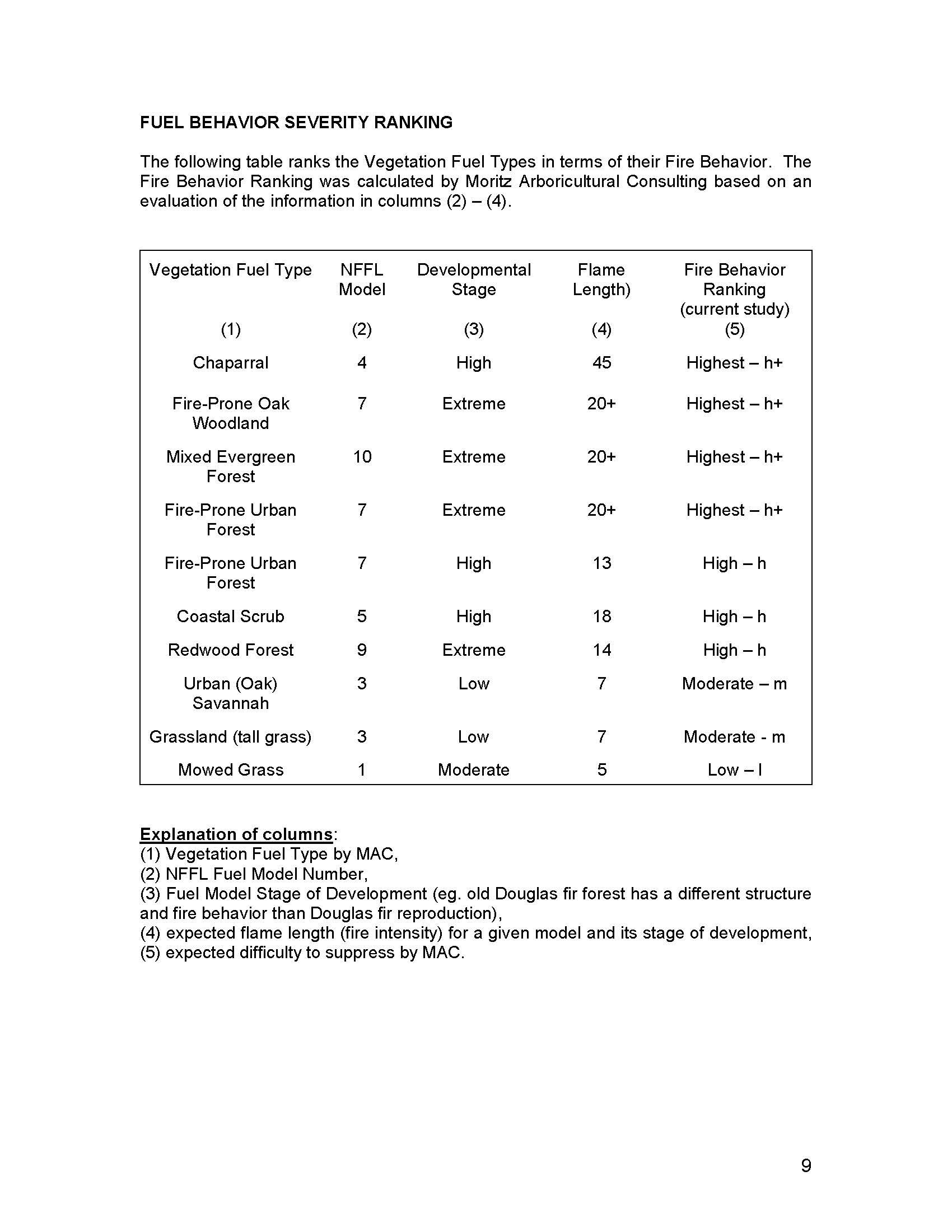
The Moritz study began by assessing the relative fire behavior of each of the various vegetative fuel types within town. It then ranked each vegetative fuel type according to the relative degree of fire hazard it created:
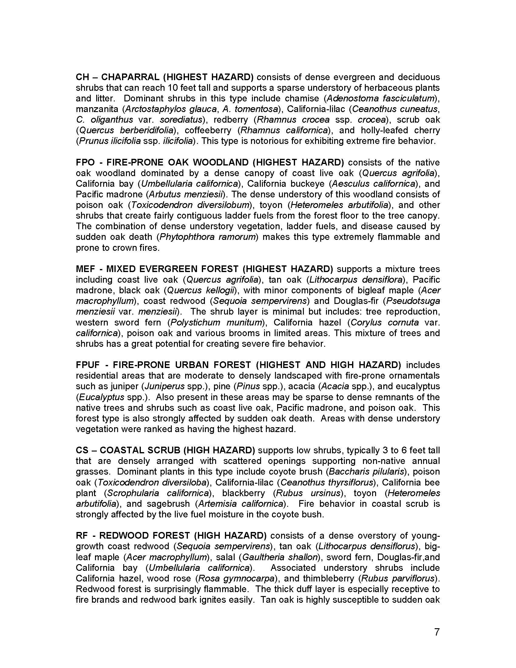
Highest (h+) Hazard: Chapparal, Fire-Prone Oak Woodland, Mixed Evergreen Forrest, Fire-Prone Urban Forrest (heavy undergrowth)
High (h) Hazard: Fire-Prone Urban Forrest, Redwood Forrest
Moderate (m) Hazard: Urban Savannah, Grasslands
Low (l) Hazard: Mowed Grass, Vineyards
Moritz then surveyed the properties throughout town to determine the prevalence and extent of each vegetative fuel type within town. Based on its survey, Moritz then classified each area of town by its category of vegetative fire hazard and prepared a Fire Hazards Map depicting its assessment of the relative fire hazard throughout town. While the map is too large to reproduce here in any legible manner, it shows the locations throughout town of over nineteen (19) discrete areas classified by Moritz as Highest Fire Hazard. The copy of the map produced below shows the approximate locations of the areas classified by Moritz as the Highest Fire Hazard areas in town based on its 2008 survey of vegetation in town.

In addition, the 2008 Moritz Fuel Hazard Assessment examined the vegetation surrounding the major collector roads that can be used to direct residents to the three arterial evacuation routes (Alpine, Portola and Los Trancos Roads) in the event of a major wildfire. Based on its assessment of the fire hazards posed by the vegetation surrounding these roads, Moritz recommended creation of a Fuel Modification Zone (FMZ) extending 20 feet from each side of the paved surface of the following collector and arterial roads to ensure safe access and egress in fire emergencies and evacuations: Portola Road, Westridge Drive, Cervantes Road, Golden Oak Drive, Alpine Road, Indian Crossing/Valley Oak, Los Trancos Road and Wayside Road.
read the 2008 moritz fuel hazard assessment:

shortfalls of the moritz hazard assessment
Notably, the 2008 Moritz study did not address factors other than vegetation — such as wind, topography and surrounding terrain — that critically affect the intensity and explosive growth of wildfire. Nor did it assess how these critical factors can interact to increase the severity or alter the spread of wildfire. Or how access to and egress from hazardous lands, adequate water supply, functioning utilities and effective communication also impact the ability to suppress or escape a wildfire.
Consequently, while the fuel assessment and fire hazard map prepared by Moritz in 2008 are a useful first step, they do not provide a comprehensive assessment of current wildfire hazards in Portola Valley, or the wildfire risks those hazards pose to surrounding properties and the community at large. And even more importantly, they do not provide the guidance we need to implement suitable wildfire-safe land use policies and development standards to address the hazards and risks our town confronts.
the general plan’s safety element
In 2010 the General Plan’s Safety element called for the Town to establish a public information program utilizing the Moritz report and map to inform residents of the vegetative fire hazards within town and certain steps needed to reduce those hazards. Unfortunately, 10 years after the Safety element was written, and 12 years after the Moritz report was prepared, the Town has still initiated no program to use the Moritz report or map to inform or educate the Town’s residents regarding the extreme wildfire hazard vegetation creates in Portola Valley or the risks it poses. Indeed, the Town has not even published the Moritz report or map on its website.
The Safety element also called for the Town to prepare and implement an Emergency Plan to protect persons and property in the event of an emergency, and to provide for the coordination of emergency services of the town with other public agencies, such as the Woodside Fire Protection District and Cal Fire. The Safety element specifically calls for:
The establishment and maintenance of an emergency operations center as a high priority of the Town;
Periodically conducting routine emergency exercises to continually test and improve the Emergency Plan and system; and
Conducting major town-wide emergency exercises on carefully prepared scenarios of the major events likely to face the town, most notably wildland fires and earthquakes.
Ten years later, many of these important policies have not been fully implemented. The Town has established an emergency operations center and developed procedures to staff and operate the center in emergencies. Few residents are aware of or familiar with the functions or capabilities of the center, or how to access and use them. Information regarding the center can be accessed by searching the Town’s website for “emergency operations center” or by clicking this link: EOC.
While the Woodside Fire and Protection District has prepared and provided a proposed Emergency Evacuation Plan for the town, the plan has not been implemented, widely publicized or practiced on a Town-wide basis.
The Woodside Fire Protection District has developed a neighborhood self-help program — called WPV-Ready or Citizens Emergency Response Preparedness Program (CERPP) — for Portola Valley and Woodside that divides Portola Valley into nine (9) district neighborhoods with volunteer leaders for emergency preparation and response. Information regarding the program can be accessed on the Fire Protection District’s WPV-Ready website or on the Town’s website under the “Residents” tab on the CERPP Response Team page. In addition, the Town’s website provides emergency preparedness information and links on its website under the Residents tab.
The Town and various neighborhoods within town have periodically conducted small scale drills and exercises for the emergency operations center and neighborhood communication and response. The Town has yet to conduct any town-wide exercise or drill to test procedures for town-wide emergency evacuation in case of wildfire or earthquake.
In April 2019 the Town created an ad hoc Wildfire Preparedness Committee to advise the Town Council. The ad hoc Committee has since met several times and has recommended various vegetation removal initiatives and outreach programs as well as certain infrastructure improvements. The latest recommendations of the Committee can be found on the Town website under Ad Hoc Wildfire Preparedness Committee.
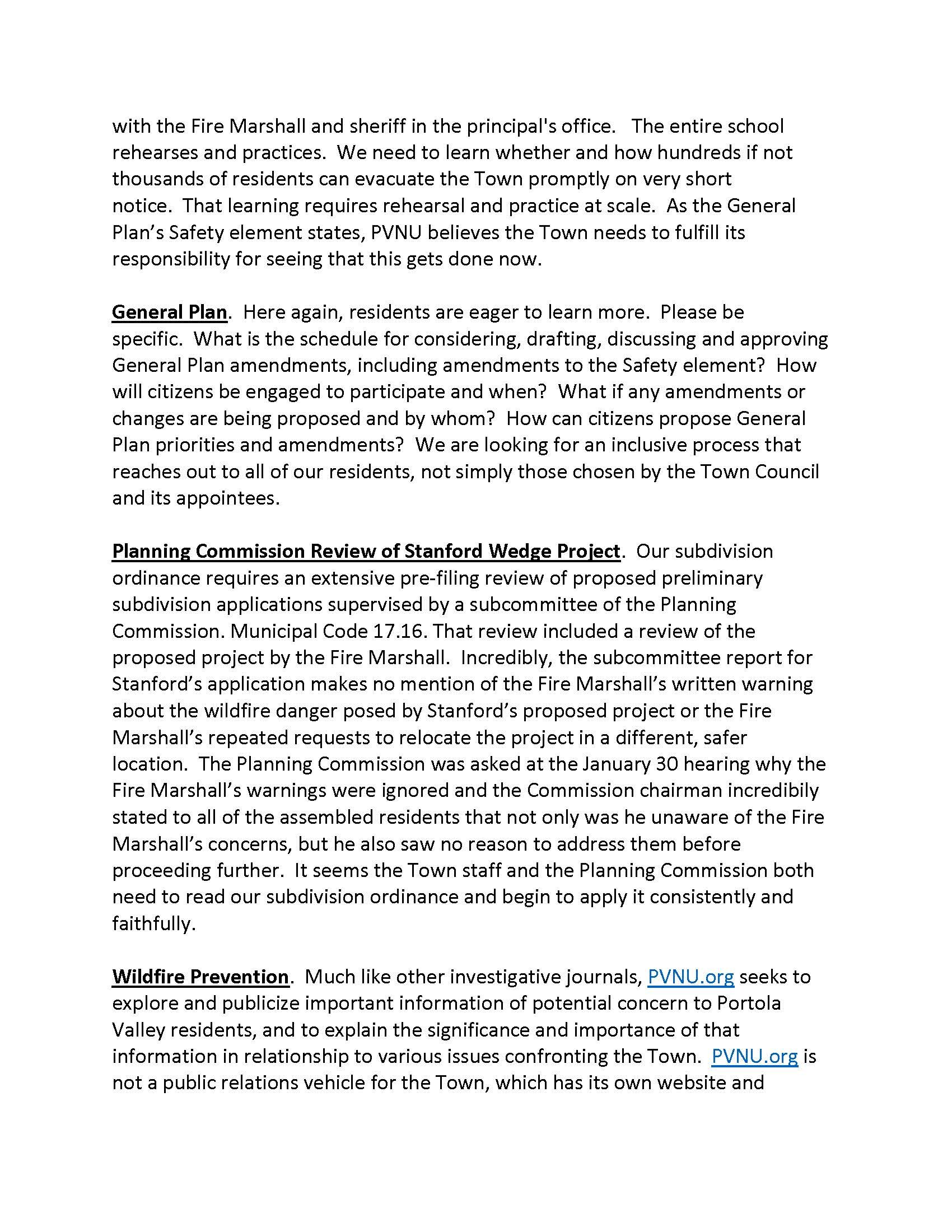
Much has been done by Town staff and many dedicated residents working on a volunteer basis largely at a neighborhood scale. PVNU believes that more can and should be done on a Town-wide basis, particularly in light of the learning gained from California’s many recent catastrophic wildfires.
going forward
First, as the General Plan provides, the Town should promptly address the enormous challenges of an urgent Town-wide evacuation by organizing and conducting major Town-wide emergency evacuation drills. The challenges entailed in organizing, communicating, executing and directing such a large scale evacuation of all Town residents and livestock on an urgent basis are daunting to say the least. Unless and until we confront and address those challenges on a Town-wide scale in actual drills, we are simply not prepared to deal with any realistic wildfire or earthquake scenario.
Second, the General Plan’s Safety element should be updated to incorporate the lessons learned from California’s most recent experiences with catastrophic wildfires in communities like Portola Valley. In 2012 California enacted Senate Bill 1241 requiring all cities — like Portola Valley — with Very High Fire Hazard Severity Zones to revise the Safety element of their General Plans to assess with specificity the wildfire hazards and risks confronting the community and to adopt policies and programs to address and reduce unreasonable wildfire risks. In May 2015 the Governor’s Office of Planning and Research issued a 55 page Fire Hazard Planning Advisory that details the steps Portola Valley needed to take to implement SB 1241.
In August 2018 Cal Fire and the State Board of Forestry and Protection issued California’s Strategic Fire Plan. The Plan outlines the priority goals deemed critical to promoting fire prevention, natural resource management and improved fire suppression, including
Availability and use of a comprehensive, community-wide wildfire hazard and risk assessment
Promotion of local planning processes, including general plan policies and regulation of new and existing developments as well as individual landowner/homeowner responsibilities
Improved fire-resistance of man-made assets and fire resilience of wildland environments
Enhanced vegetative fuels management practices
In November 2020 the Governor’s Office of Planning and Research released its updated Fire Hazard Planning and Technical Advisory, documenting the ever-expanding hazards and risks confronting California communities since the initial 2015 advisory and underscoring the critical need for local governments to adopt Safety elements, mitigation measures and wildfire protection plans to address and reduce the wildfire hazards and risks confronting them.
The Town has yet to implement or respond to any of these legislative directives or guidances. Portola Valley’s Safety element should be amended to identify the principal factors that can cause or exacerbate wildfires in Portola Valley’s ecosystems, define the topographical and fuel conditions that constitute Very High and High Fire Hazard zones within Town, and then apply that knowledge to revise the Town’s land use policies and ordinances to enhance the safety of development in Very High and High Fire Hazard zones within Town.
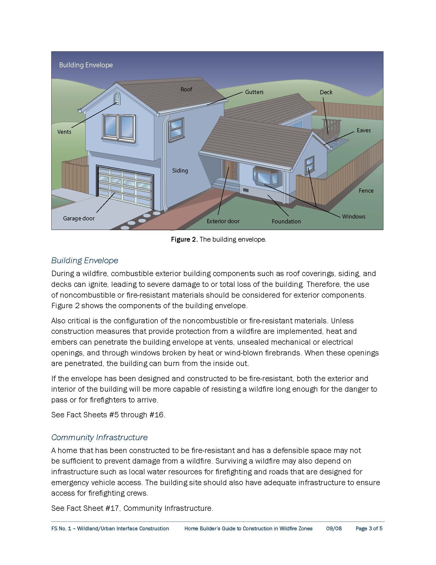
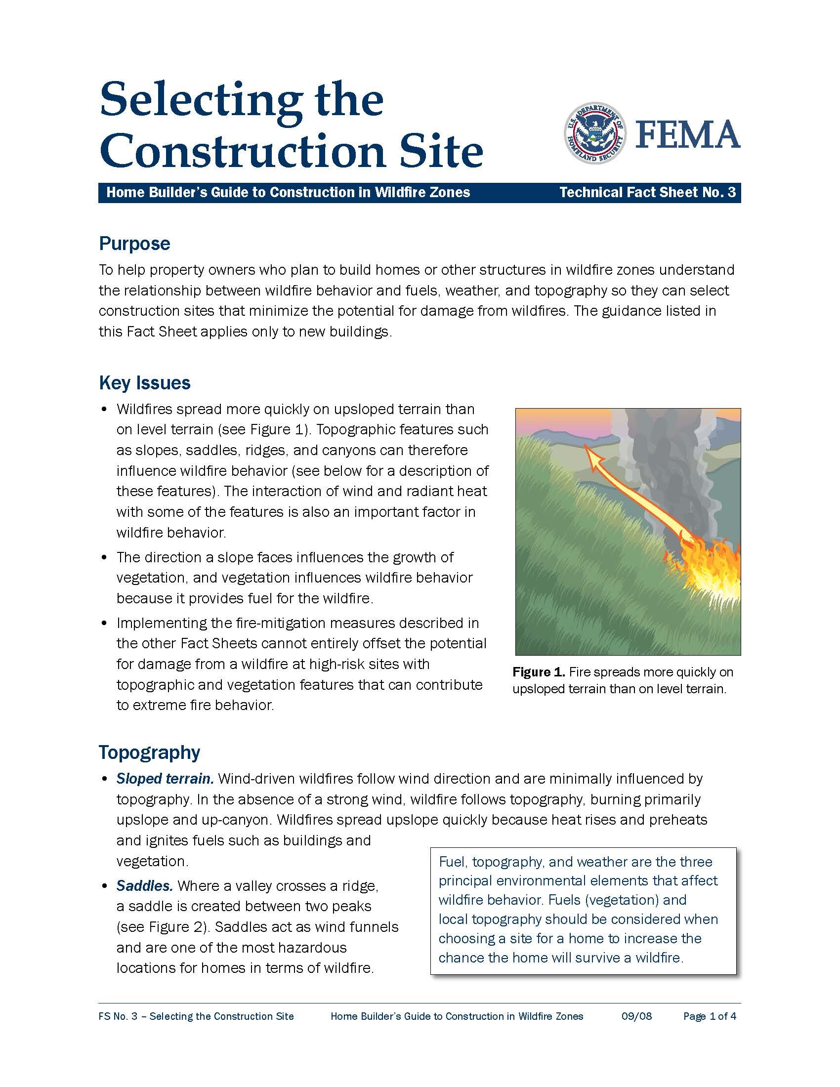
The first line of defense against catastrophic wildfires is safe land use policy and site development standards. Much like the Town’s long-standing policies and ordinances promoting seismic safety by assessing the known and inferred geologic hazards and risks of each site, so too should we promote wildfire safety by assessing the wildfire hazards and risks posed by a proposed site’s vegetative, topographic and structural features.
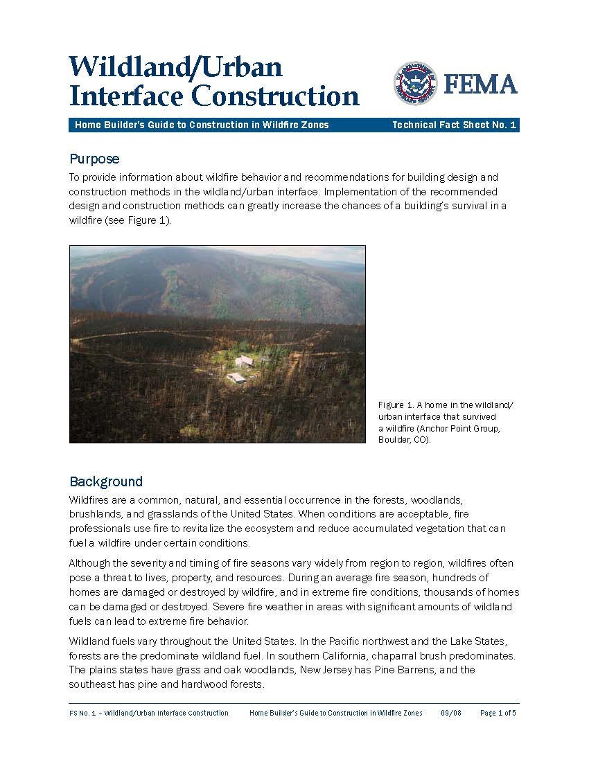
As the Federal Emergency Management Agency (FEMA) has warned, whenever a construction site is selected,
“the topographic features on and surrounding a site should be evaluated for their potential contribution to the exposure of a building to a wildfire. A building’s configuration and location on a site should be predicated on minimizing the risk from these topographic features.”
read fema’s guidance on wildfire-safe land use and site development standards for wui lands
In particular, the General Plan’s Safety element should
Assess the local topographic, climatic, seasonal and weather conditions that can accelerate and exacerbate the rapid spread of wildfire throughout our community;
Assess the way in which unsafe land use policy and/or development can threaten the lives and property of neighboring property owners as well as those within a proposed development;
Consider how seismic events can cause and contribute to the rapid, uncontrolled proliferation and spread of fire through multiplication of ignition sources as well as disruption of water supplies and electrical or communication service;
Assess the fire hazard that existing gas, electric and solar utilities pose within town and implement appropriate steps to reduce such hazards;
Structure and provide for implementation of suitable hazard and risk assessments in all land use decisions;
Provide for community-wide programs to restore healthy forests and reduce flammable vegetation and other fuels through ecological thinning to mitigate the risk of wildfire ignition and spread in the community; and
Address the potential, urgent need to evacuate town and provide comprehensive procedures to timely inform residents of evacuation orders, safe routes of escape to implement such orders, and appropriate procedures to organize and administer post-evacuation relief and recovery activities.
The day after a wildfire sweeps through town is far too late to get started. The Town needs to realign its priorities and act on them now.
Third, the Town should adopt a new wildfire safety ordinance that:
Applies the lessons learned from the Moritz Report and California’s most recent catastrophic wildfires to define and establish Very High and High Fire Hazard Severity Zones within Town based on a comprehensive, town-wide assessment of hazards and risks posed by vegetative and structural fuels, topography and surrounding terrain, residences and essential infrastructure.
Adopts wildfire-safe land use and building standards for those zones, much like the Town’s seismic safety policies and ordinances adopted 50 years ago;
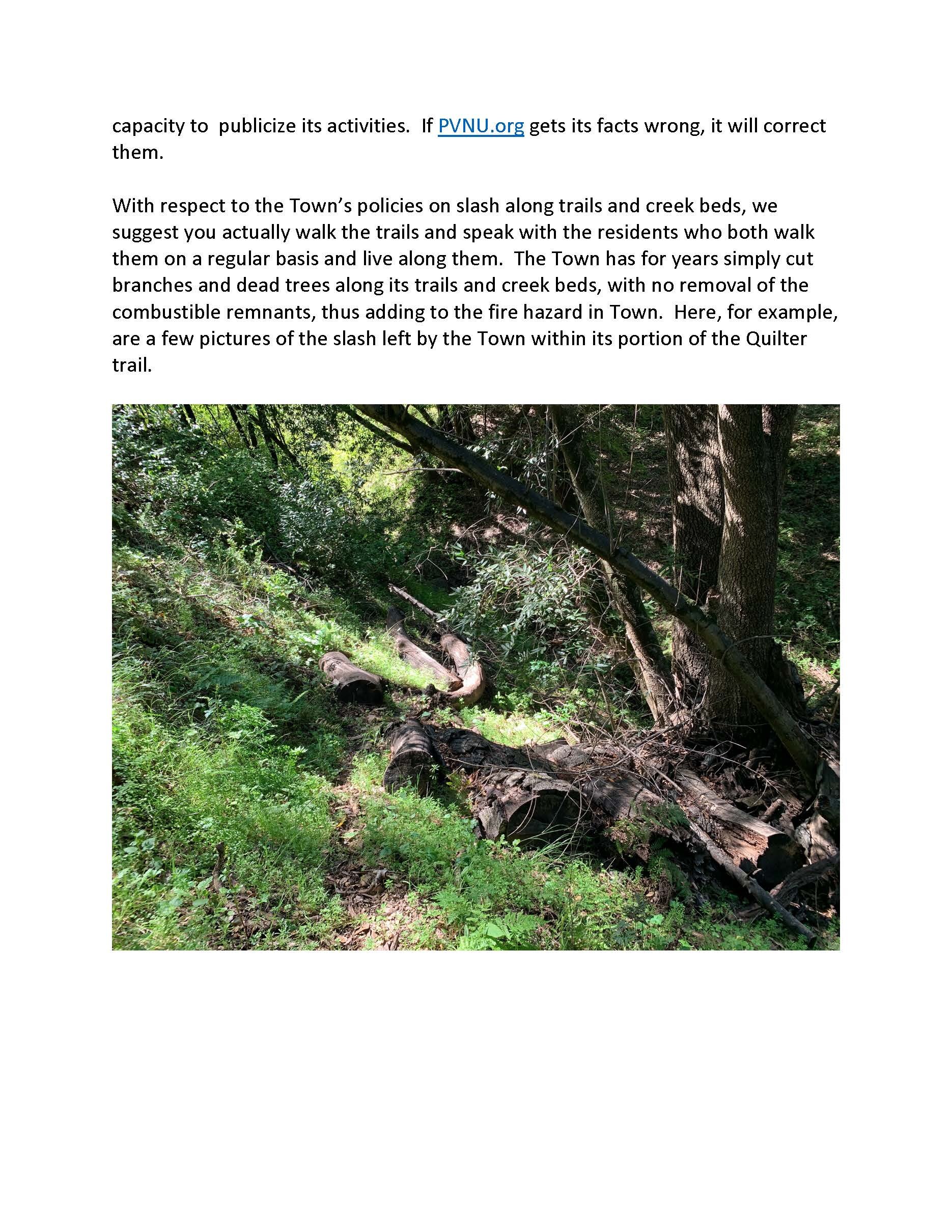
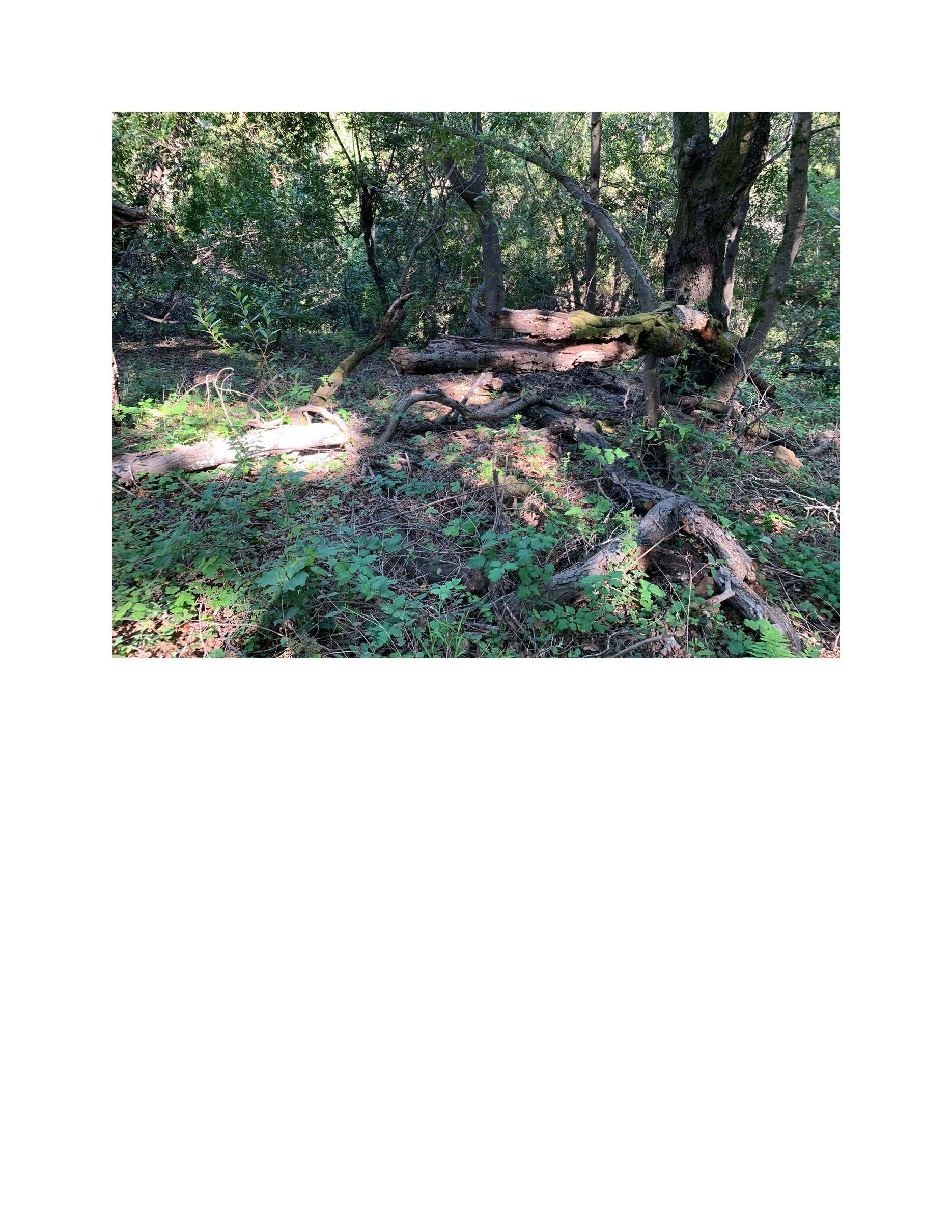
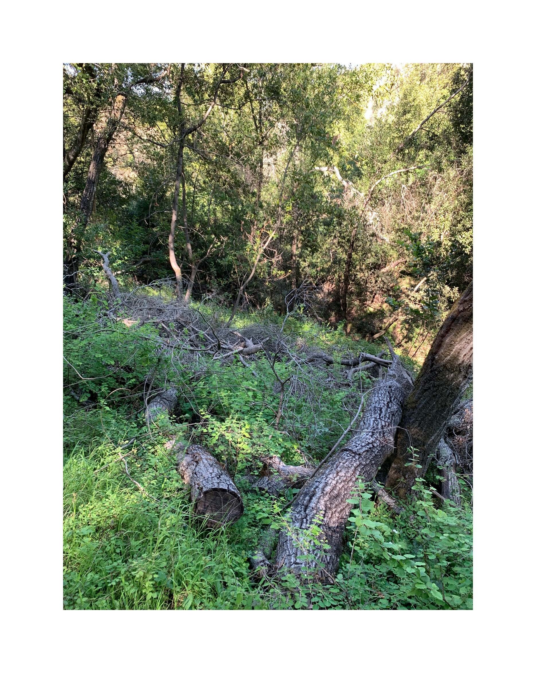
Amends the fire ordinance to empower the Woodside Fire Protection District to require the removal of excessive ladder fuels and dead vegetation from any property within Very High and High Fire Hazard zones in Portola Valley; and
Establishes a Public Safety Officer in Town government to implement and enforce the wildfire prevention, safety and emergency preparedness policies and requirements of the Town’s General Plan and municipal code.
The 2008 Moritz Fuel Hazard Assessment Study and Map provide excellent building blocks on which to develop the necessary policies and standards for defining and regulating safe site selection and development practices in Very High and High Wildfire Hazard zones within Portola Valley.
By overlaying an analysis of the hazardous fuel sources in town onto the topography underlying those fuels and the structures surrounding and intermingled with them, we can construct an integrated assessment of the possible intensity and spread of wildfire within Portola Valley under a variety of weather conditions. Only such an integrated depiction of vegetation, terrain and infrastructure can reveal the full character and extent of the hazards and risks our landscape creates.
The following graphic illustrates the vegetative fuels mapped in the Moritz study juxtaposed with the underlying topography and surrounding terrain of the Stanford Wedge.

Integrating the analysis of vegetative hazard portrayed in the Moritz map (left) with the land’s underlying topography and surrounding terrain (right) reveals critical additional information about the extent and severity of the hazards present on the land, as well as the nature and extent of the risks those hazards pose to surrounding lands.
Not only is the land characterized by Very High Hazard vegetative fuels, but those fuels are situated in a narrowing ravine closed at its western end with steep juxtaposed slopes that rise well over 300 feet above the floor of the ravine to hundreds of surrounding properties and homes. Many of those homes are themselves situated amongst Very High Hazard vegetative fuels on topographies also characterized by steep slopes and ravines running in multiple directions.
The southern, southeastern and eastern aspects of the ravine’s steep slopes prolong their exposure to sun which dries their vegetative cover during the summer and fall months. The ravine’s closely juxtaposed walls in combination with its closed western end create a chimney-like structure that intensifies the thermal energy of any fire, causing pre-heating of vegetative fuels and an uplift and spread of burning embers.
The steepness of the slopes would further intensify and accelerate the spread of any fire away from the ravine’s floor in multiple directions simultaneously, toward the southwest, the west and the northwest.

The simultaneous spread of fire in different directions above and beyond the ravine toward Minoca Road, toward Cervantes Road, and toward Westridge Drive would greatly increase the resources needed to contain and suppress a fire in the ravine.
Among those resources is water. Because the ridgelines and surrounding properties are 300 to 500 feet above the mouth of the ravine, pressurized water needed to suppress a fire emanating from the ravine must be drawn from the restricted supply on hand in the water storage tanks along Golden Oak and Goya.
Fire spreading into any or all of these neighborhoods could intercept and potentially block important access and evacuation routes along Westridge Drive, Cervantes, Minoca and Golden Oak, jeopardizing both fire-fighting and evacuation efforts.
The integration of vegetative and topographical analyses illustrates the insight and forewarning a competent hazard-risk assessment can provide. It also demonstrates why such assessments can provide a critical tool that enables us to anticipate and hopefully prevent the catastrophic spread of wildfire.
But such integrated assessments are only a tool. They can inform but they cannot make the critical judgments and policy decisions required to apply and uphold safe development standards and practices that serve to prevent and not exacerbate or ignore wildfire hazards and risks.
As FEMA has explained, such policies necessarily require an informed understanding of the relationship between wildfire behavior, and the weather, fuels and topographical features that spawn and spread wildfires. While no set of land use and development policies or practices can anticipate all of the circumstances that combine to create catastrophic fires in the Wildlands-Urban Interface, there are a few fundamental principles that should be universally applied to reduce the occurrence and severity of wildfire ignition and spread. For example:
Wildfires follow topography, burning primarily up-slope and up-canyon
The aspect (direction) of sloped land affects its exposure to the drying effects of sunlight, causing fire to ignite more easily and spread more rapidly
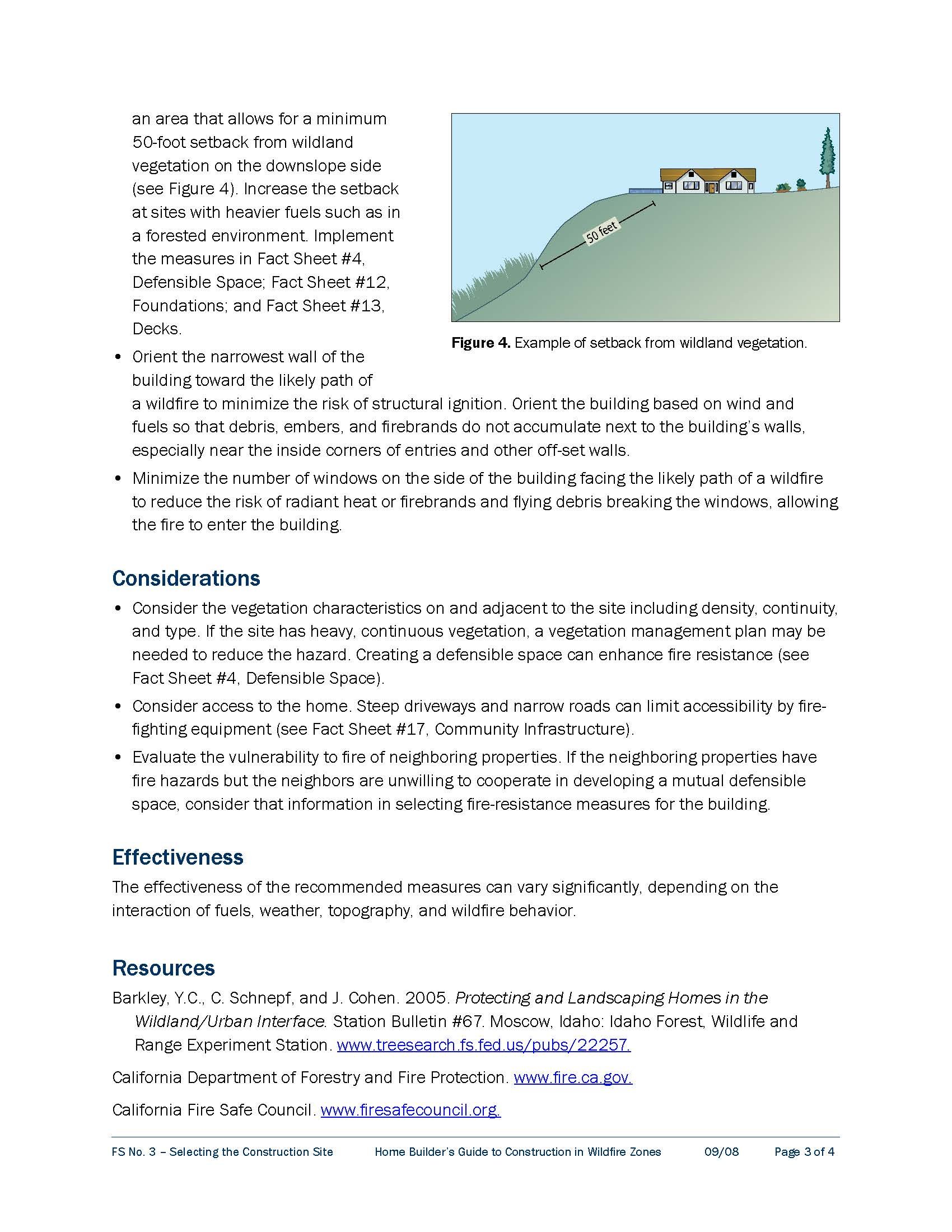
Ravines and canyons — with multiple juxtaposed slopes — can funnel and accelerate wind flows in multiple directions leading to extreme fire behavior
Saddles, ravines and canyons can also cause fire to spread up-slope in multiple directions simultaneously
A wildfire at the bottom of a canyon can lead to extremely hazardous conditions up-slope, because the canyon acts like a chimney, collecting hot gasses and directing super-heated convection and radiant heat up-slope
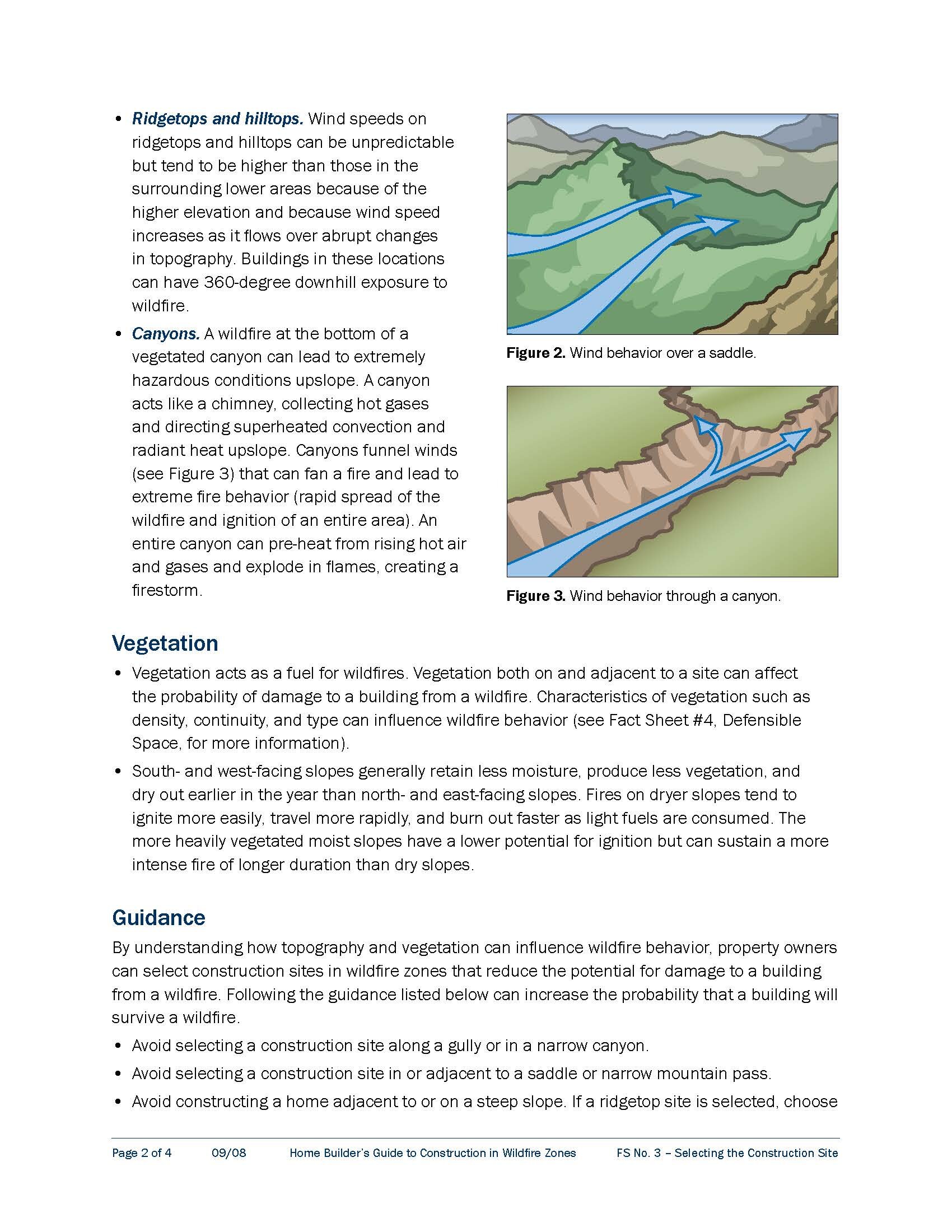
Wind speed increases as it flows over abrupt changes in topography
Wind speeds on ridge tops and hilltops can be unpredictable but tend to be higher than those in surrounding areas
What has the CZU Fire taught us — yet again!
Read the position of the Woodside Fire Protection District on an ordinance requiring wildfire-safe land use policies and regulations, including the removal of ladder fuels, dense underbrush and dead vegetation from VERY High and high fire hazard zones
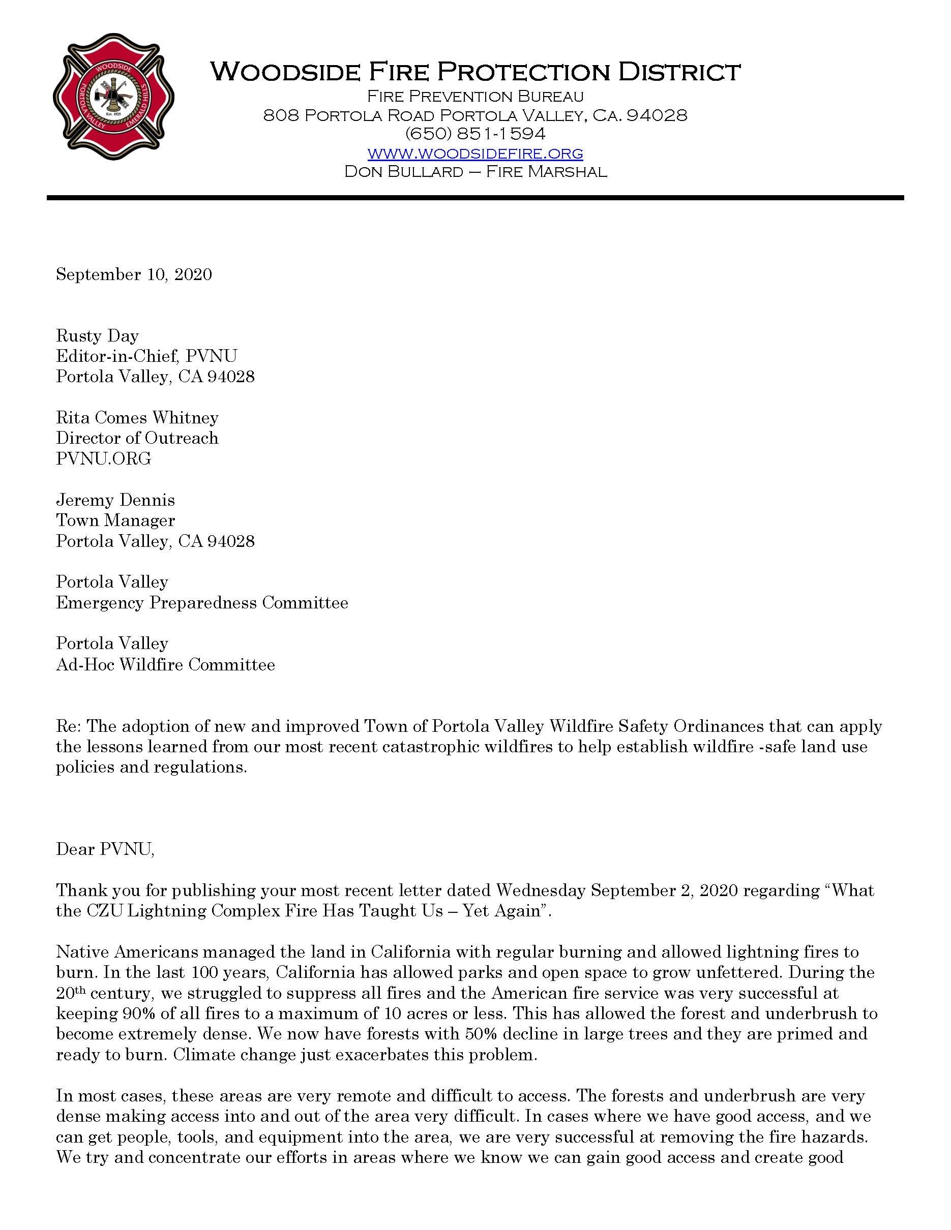
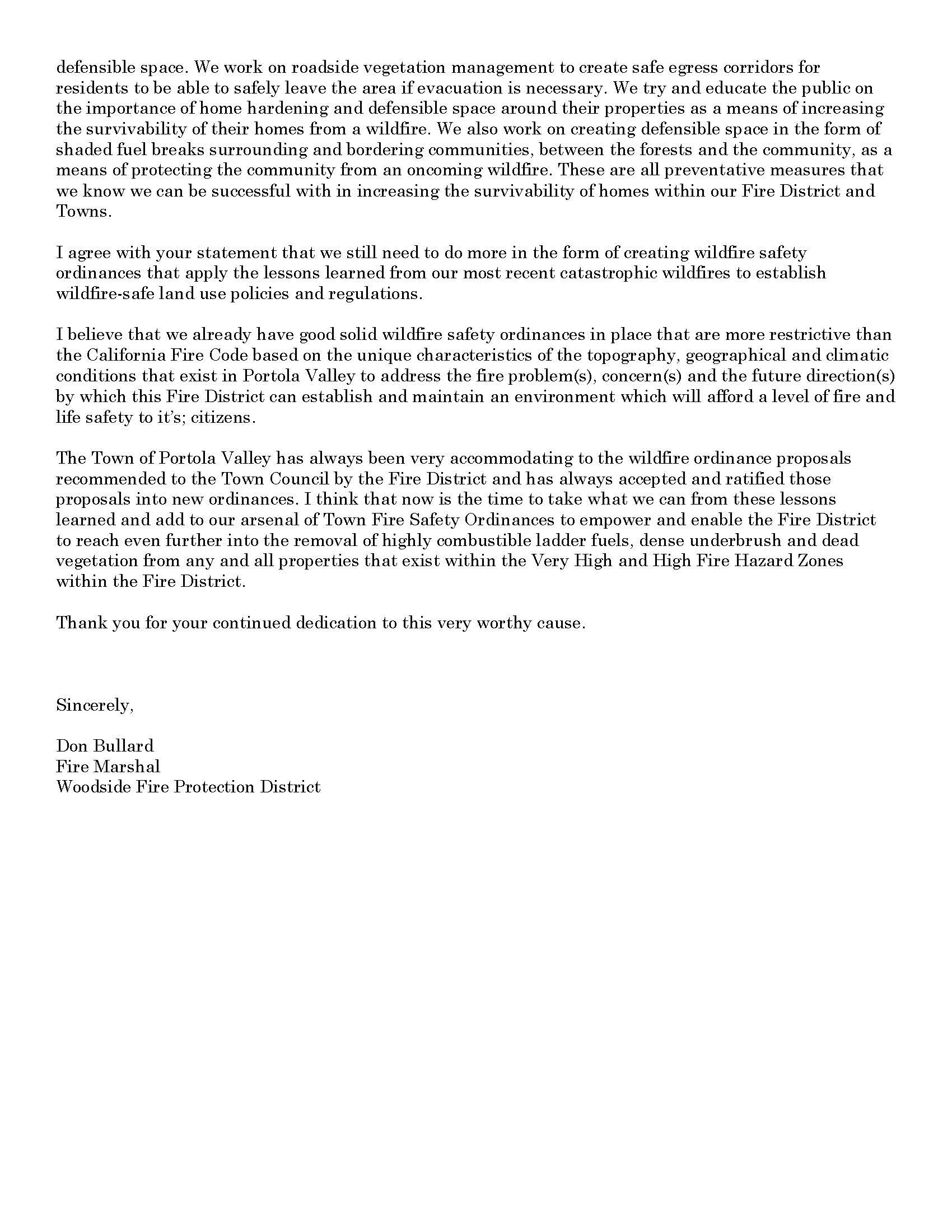
Read the Town’s response and PVNU’s reply below